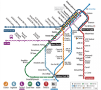
Loading map...
{"format":"googlemaps3","type":"ROADMAP","minzoom":false,"maxzoom":false,"types":["ROADMAP","SATELLITE","HYBRID","TERRAIN"],"limit":500,"offset":0,"link":"all","sort":[""],"order":[],"headers":"show","mainlabel":"","intro":"","outro":"","searchlabel":"... further results","default":"","import-annotation":false,"width":"100%","height":"450px","centre":false,"title":"","label":"","icon":"","lines":[{"text":"\u003Cb\u003E\u003Cdiv class=\"mw-parser-output\"\u003E\u003Cp\u003EJ-Church\n\u003C/p\u003E\u003C/div\u003E\u003C/b\u003E\u003Cdiv class=\"mw-parser-output\"\u003E\u003Cp\u003EJ-Church\n\u003C/p\u003E\u003C/div\u003E","title":"J-Church\n","link":"","strokeColor":"orange","strokeOpacity":"1","strokeWeight":"8","pos":[{"lat":37.721519192471,"lon":-122.44734799722},{"lat":37.721179733981,"lon":-122.44714414934},{"lat":37.720916652582,"lon":-122.44645750383},{"lat":37.726924859273,"lon":-122.4414793239},{"lat":37.728902029745,"lon":-122.44011676172},{"lat":37.730047576467,"lon":-122.43828213075},{"lat":37.730200314691,"lon":-122.43777787546},{"lat":37.730565188062,"lon":-122.43607199052},{"lat":37.73076035215,"lon":-122.43566429475},{"lat":37.731549488653,"lon":-122.43521368364},{"lat":37.731965266869,"lon":-122.43472015718},{"lat":37.734629586143,"lon":-122.42923772195},{"lat":37.735724135386,"lon":-122.42742454866},{"lat":37.737285324909,"lon":-122.42548262933},{"lat":37.738091365104,"lon":-122.42479598382},{"lat":37.739050112348,"lon":-122.42436683038},{"lat":37.740670621495,"lon":-122.42393767694},{"lat":37.74230806329,"lon":-122.42326176027},{"lat":37.742112929641,"lon":-122.4265447841},{"lat":37.754871890446,"lon":-122.42773568491},{"lat":37.755431741265,"lon":-122.42725288728},{"lat":37.756025517808,"lon":-122.4273172603},{"lat":37.75634785165,"lon":-122.42698466638},{"lat":37.756576877473,"lon":-122.42690956453},{"lat":37.757577796826,"lon":-122.42700612405},{"lat":37.757721995956,"lon":-122.42722070077},{"lat":37.757730478249,"lon":-122.42762839654},{"lat":37.75792557072,"lon":-122.42786443094},{"lat":37.758858614551,"lon":-122.42788588861},{"lat":37.760758594699,"lon":-122.42807900766},{"lat":37.761369292239,"lon":-122.42834722856},{"lat":37.769469039589,"lon":-122.42906606058}]},{"text":"","title":"","link":"","strokeColor":"black","strokeOpacity":"1","strokeWeight":"2","pos":[{"lat":37.734807769681,"lon":-122.4716166257},{"lat":37.731057339993,"lon":-122.47177755824},{"lat":37.729640272996,"lon":-122.46862328175},{"lat":37.729139626077,"lon":-122.46815121296},{"lat":37.728257121572,"lon":-122.46768987301},{"lat":37.727654636495,"lon":-122.46718561772},{"lat":37.72675514261,"lon":-122.46602690342},{"lat":37.726483595139,"lon":-122.46549046162},{"lat":37.724939149966,"lon":-122.46117746952},{"lat":37.722987332525,"lon":-122.45185411099},{"lat":37.722961873697,"lon":-122.44707977894},{"lat":37.721519192471,"lon":-122.44734799984}]},{"text":"","title":"","link":"","strokeColor":"black","strokeOpacity":"1","strokeWeight":"2","pos":[{"lat":37.738048942373,"lon":-122.5044039487},{"lat":37.737998035063,"lon":-122.50543391696},{"lat":37.736139894303,"lon":-122.50529444209},{"lat":37.736182318128,"lon":-122.50423228732},{"lat":37.741790533788,"lon":-122.50462925425},{"lat":37.743241304066,"lon":-122.47135913363},{"lat":37.741383294915,"lon":-122.4712303876},{"lat":37.741527525605,"lon":-122.4677757037},{"lat":37.741434199897,"lon":-122.46701395634},{"lat":37.741196643016,"lon":-122.46635949734},{"lat":37.740925148504,"lon":-122.46584451321}]},{"text":"","title":"","link":"","strokeColor":"black","strokeOpacity":"1","strokeWeight":"2","pos":[{"lat":37.73479928476,"lon":-122.4716166257},{"lat":37.734120487959,"lon":-122.4720350503},{"lat":37.731184620133,"lon":-122.47432029239},{"lat":37.730616100482,"lon":-122.47460997096},{"lat":37.729377221647,"lon":-122.47478163234},{"lat":37.720449892961,"lon":-122.47525370112},{"lat":37.720110429571,"lon":-122.47521078578},{"lat":37.719720044749,"lon":-122.47498548022},{"lat":37.71427990306,"lon":-122.46982491139},{"lat":37.714296877602,"lon":-122.46275460842},{"lat":37.714076208249,"lon":-122.46260440472},{"lat":37.713159574672,"lon":-122.46258294705},{"lat":37.713218986451,"lon":-122.45348489407},{"lat":37.713762177652,"lon":-122.45249784115},{"lat":37.71748802246,"lon":-122.44931137684},{"lat":37.718166971718,"lon":-122.44893586758},{"lat":37.718820454502,"lon":-122.44804537419},{"lat":37.719813397829,"lon":-122.44739091519},{"lat":37.720517785452,"lon":-122.44679010037}]},{"text":"","title":"","link":"","strokeColor":"black","strokeOpacity":"1","strokeWeight":"2","pos":[{"lat":37.760275122237,"lon":-122.50924265507},{"lat":37.762183547783,"lon":-122.46619856218},{"lat":37.764049516264,"lon":-122.46631657938},{"lat":37.764422704311,"lon":-122.45784079889},{"lat":37.764829816396,"lon":-122.45765840868},{"lat":37.765856068167,"lon":-122.44950449327},{"lat":37.766381910664,"lon":-122.44889294961},{"lat":37.769240053682,"lon":-122.43468797067},{"lat":37.769316382396,"lon":-122.433357595},{"lat":37.769223091734,"lon":-122.43278896669},{"lat":37.769469039589,"lon":-122.42906606058}]},{"text":"","title":"","link":"","strokeColor":"black","strokeOpacity":"1","strokeWeight":"2","pos":[{"lat":37.734800279087,"lon":-122.47161698357},{"lat":37.736412396526,"lon":-122.47071576134},{"lat":37.737125110941,"lon":-122.47007203117},{"lat":37.740196492182,"lon":-122.46644568459},{"lat":37.740926138606,"lon":-122.46584486977}]},{"text":"","title":"","link":"","strokeColor":"black","strokeOpacity":"1","strokeWeight":"2","pos":[{"lat":37.740925148504,"lon":-122.46583378323},{"lat":37.746188147501,"lon":-122.461167812},{"lat":37.748224187282,"lon":-122.4589362141},{"lat":37.761770908771,"lon":-122.43792915309},{"lat":37.762072013095,"lon":-122.4363842007},{"lat":37.762949873636,"lon":-122.43469977344},{"lat":37.769714986625,"lon":-122.42615854731}]},{"text":"\u003Cb\u003E\u003Cdiv class=\"mw-parser-output\"\u003E\u003Cp\u003EJ-Church\n\u003C/p\u003E\u003C/div\u003E\u003C/b\u003E\u003Cdiv class=\"mw-parser-output\"\u003E\u003Cp\u003EJ-Church\n\u003C/p\u003E\u003C/div\u003E","title":"J-Church\n","link":"","strokeColor":"orange","strokeOpacity":"1","strokeWeight":"8","pos":[{"lat":37.769460558642,"lon":-122.42906606205},{"lat":37.769655620174,"lon":-122.42640531071},{"lat":37.769714986625,"lon":-122.42615854748}]},{"text":"","title":"","link":"","strokeColor":"black","strokeOpacity":"1","strokeWeight":"2","pos":[{"lat":37.794801525945,"lon":-122.4080643653},{"lat":37.786168257048,"lon":-122.40631824723},{"lat":37.774447187283,"lon":-122.39165461055},{"lat":37.774540471353,"lon":-122.38985216609},{"lat":37.76303172111,"lon":-122.38874709597},{"lat":37.761691602797,"lon":-122.38868272296},{"lat":37.757917088449,"lon":-122.38831794253},{"lat":37.756305439382,"lon":-122.3880711793},{"lat":37.745268941195,"lon":-122.38710558537},{"lat":37.744751432395,"lon":-122.38719141606},{"lat":37.728443810238,"lon":-122.39294207087},{"lat":37.719465448988,"lon":-122.3969653844},{"lat":37.717946318036,"lon":-122.3982743024},{"lat":37.717521974215,"lon":-122.39836013308},{"lat":37.716732688243,"lon":-122.39829576007},{"lat":37.71626590226,"lon":-122.39836013308},{"lat":37.715272911386,"lon":-122.39885365954},{"lat":37.714907962678,"lon":-122.39916479579},{"lat":37.714424190689,"lon":-122.39936864367},{"lat":37.712845544334,"lon":-122.40089213839},{"lat":37.712548483465,"lon":-122.40126764766},{"lat":37.712175033825,"lon":-122.40267312518},{"lat":37.711894945359,"lon":-122.40313446513},{"lat":37.709713614114,"lon":-122.4047330617},{"lat":37.708406482135,"lon":-122.40531241885}]},{"text":"","title":"","link":"","strokeColor":"black","strokeOpacity":"1","strokeWeight":"2","pos":[{"lat":37.793933511108,"lon":-122.39554953558},{"lat":37.794764364135,"lon":-122.3944551943},{"lat":37.794815232385,"lon":-122.39404749853},{"lat":37.794713495851,"lon":-122.39357542974},{"lat":37.792407430186,"lon":-122.39100050909},{"lat":37.792000469949,"lon":-122.39082884771},{"lat":37.791288284142,"lon":-122.39048552496},{"lat":37.790966102594,"lon":-122.3901422022},{"lat":37.789524746885,"lon":-122.38842558843},{"lat":37.788846452118,"lon":-122.38806080801},{"lat":37.787828998292,"lon":-122.38782477361},{"lat":37.781350880423,"lon":-122.38831830007},{"lat":37.780808185088,"lon":-122.38851141912},{"lat":37.780435079734,"lon":-122.38887619955},{"lat":37.776381677481,"lon":-122.39400458318}]},{"text":"\u003Cb\u003E\u003Cdiv class=\"mw-parser-output\"\u003E\u003Cp\u003EJ-Church\n\u003C/p\u003E\u003C/div\u003E\u003C/b\u003E\u003Cdiv class=\"mw-parser-output\"\u003E\u003Cp\u003EJ-Church\n\u003C/p\u003E\u003C/div\u003E","title":"J-Church\n","link":"","strokeColor":"orange","strokeOpacity":"1","strokeWeight":"8","pos":[{"lat":37.769715975824,"lon":-122.42616963402},{"lat":37.793933511108,"lon":-122.39554953558}]}],"polygons":[],"circles":[],"rectangles":[],"copycoords":false,"static":false,"visitedicon":"","wmsoverlay":false,"zoom":false,"layers":[],"controls":["pan","zoom","type","scale","streetview","rotate"],"zoomstyle":"DEFAULT","typestyle":"DEFAULT","autoinfowindows":false,"resizable":false,"kmlrezoom":false,"poi":true,"cluster":false,"clustergridsize":60,"clustermaxzoom":20,"clusterzoomonclick":true,"clusteraveragecenter":true,"clusterminsize":2,"imageoverlays":[],"kml":[],"gkml":[],"searchmarkers":"","fullscreen":false,"scrollwheelzoom":false,"showtitle":false,"hidenamespace":false,"template":"liststn2","userparam":"","activeicon":"","pagelabel":false,"ajaxcoordproperty":"","ajaxquery":"","locations":[{"text":"\u003Cp\u003E\u003Ca href=\"/24th_Street/Noe_Valley\" title=\"24th Street/Noe Valley\"\u003E24th Street/Noe Valley\u003C/a\u003E\n\u003C/p\u003E","title":"24th Street/Noe Valley","link":"","lat":37.7514,"lon":-122.4318,"icon":""},{"text":"\u003Cp\u003E\u003Ca href=\"/30th_%26_Mission\" title=\"30th \u0026amp; Mission\"\u003E30th \u0026amp; Mission\u003C/a\u003E\n\u003C/p\u003E","title":"30th \u0026 Mission","link":"","lat":37.742348,"lon":-122.42205,"icon":""},{"text":"\u003Cp\u003EBalboa Park\n\u003C/p\u003E","title":"Balboa Park Station","link":"","lat":37.721616,"lon":-122.447498,"icon":"/images/8/88/Rail20.png"},{"text":"\u003Cp\u003EChurch\n\u003C/p\u003E","title":"Church Station","link":"","lat":37.76749,"lon":-122.428964,"icon":"/images/8/88/Rail20.png"},{"text":"\u003Cp\u003ECivic Center/United Nations Plaza\n\u003C/p\u003E","title":"Civic Center/United Nations Plaza Station","link":"","lat":37.779628,"lon":-122.413623,"icon":"/images/8/88/Rail20.png"},{"text":"\u003Cp\u003EEmbarcadero\n\u003C/p\u003E","title":"Embarcadero Station","link":"","lat":37.792808,"lon":-122.396922,"icon":"/images/8/88/Rail20.png"},{"text":"\u003Cp\u003E\u003Ca href=\"/Glen_Park\" title=\"Glen Park\"\u003EGlen Park\u003C/a\u003E\n\u003C/p\u003E","title":"Glen Park","link":"","lat":37.733555,"lon":-122.434158,"icon":""},{"text":"\u003Cp\u003E\u003Ca href=\"/Lower_Haight\" title=\"Lower Haight\"\u003ELower Haight\u003C/a\u003E\n\u003C/p\u003E","title":"Lower Haight","link":"","lat":37.772057,"lon":-122.430481,"icon":""},{"text":"\u003Cp\u003E\u003Ca href=\"/Mission_Dolores\" title=\"Mission Dolores\"\u003EMission Dolores\u003C/a\u003E\n\u003C/p\u003E","title":"Mission Dolores","link":"","lat":37.764367,"lon":-122.427027,"icon":""},{"text":"\u003Cp\u003E\u003Ca href=\"/Mission_Dolores_Park\" title=\"Mission Dolores Park\"\u003EMission Dolores Park\u003C/a\u003E\n\u003C/p\u003E","title":"Mission Dolores Park","link":"","lat":37.75975,"lon":-122.427,"icon":""},{"text":"\u003Cp\u003E\u003Ca href=\"/Mission_High_School\" title=\"Mission High School\"\u003EMission High School\u003C/a\u003E\n\u003C/p\u003E","title":"Mission High School","link":"","lat":37.76174,"lon":-122.4273,"icon":""},{"text":"\u003Cp\u003EMontgomery\n\u003C/p\u003E","title":"Montgomery Station","link":"","lat":37.78912,"lon":-122.4016,"icon":"/images/8/88/Rail20.png"},{"text":"\u003Cp\u003E30th \u0026amp; Dolores\n\u003C/p\u003E","title":"Muni Metro surface stops# 30th \u0026 Dolores","link":"","lat":37.74224,"lon":-122.42425,"icon":"/images/8/88/Rail20.png"},{"text":"\u003Cp\u003EChurch \u0026amp; 14th/Market\n\u003C/p\u003E","title":"Muni Metro surface stops# Church \u0026 14th/Market","link":"","lat":37.767507,"lon":-122.428934,"icon":"/images/8/88/Rail20.png"},{"text":"\u003Cp\u003EChurch \u0026amp; 16th\n\u003C/p\u003E","title":"Muni Metro surface stops# Church \u0026 16th","link":"","lat":37.76452,"lon":-122.42866,"icon":"/images/8/88/Rail20.png"},{"text":"\u003Cp\u003EChurch \u0026amp; 18th\n\u003C/p\u003E","title":"Muni Metro surface stops# Church \u0026 18th","link":"","lat":37.7613,"lon":-122.42835,"icon":"/images/8/88/Rail20.png"},{"text":"\u003Cp\u003EChurch \u0026amp; 22nd\n\u003C/p\u003E","title":"Muni Metro surface stops# Church \u0026 22nd","link":"","lat":37.75479,"lon":-122.427741,"icon":"/images/8/88/Rail20.png"},{"text":"\u003Cp\u003EChurch \u0026amp; 24th\n\u003C/p\u003E","title":"Muni Metro surface stops# Church \u0026 24th","link":"","lat":37.751703,"lon":-122.427422,"icon":"/images/8/88/Rail20.png"},{"text":"\u003Cp\u003EChurch \u0026amp; 27th\n\u003C/p\u003E","title":"Muni Metro surface stops# Church \u0026 27th","link":"","lat":37.746893,"lon":-122.426992,"icon":"/images/8/88/Rail20.png"},{"text":"\u003Cp\u003EChurch \u0026amp; 29th (inbound)\n\u003C/p\u003E","title":"Muni Metro surface stops# Church \u0026 29th (inbound)","link":"","lat":37.74363,"lon":-122.42672,"icon":"/images/8/88/Rail20.png"},{"text":"\u003Cp\u003EChurch \u0026amp; 30th (inbound)\n\u003C/p\u003E","title":"Muni Metro surface stops# Church \u0026 30th (inbound)","link":"","lat":37.74215,"lon":-122.42643,"icon":"/images/8/88/Rail20.png"},{"text":"\u003Cp\u003EChurch \u0026amp; Clipper\n\u003C/p\u003E","title":"Muni Metro surface stops# Church \u0026 Clipper","link":"","lat":37.749295,"lon":-122.427204,"icon":"/images/8/88/Rail20.png"},{"text":"\u003Cp\u003EChurch \u0026amp; Day\n\u003C/p\u003E","title":"Muni Metro surface stops# Church \u0026 Day","link":"","lat":37.74291,"lon":-122.4266,"icon":"/images/8/88/Rail20.png"},{"text":"\u003Cp\u003EDuboce \u0026amp; Church\n\u003C/p\u003E","title":"Muni Metro surface stops# Duboce \u0026 Church","link":"","lat":37.769426,"lon":-122.42935,"icon":"/images/8/88/Rail20.png"},{"text":"\u003Cp\u003EGlen Park\n\u003C/p\u003E","title":"Muni Metro surface stops# Glen Park","link":"","lat":37.732492,"lon":-122.433577,"icon":"/images/8/88/Rail20.png"},{"text":"\u003Cp\u003ERight Of Way \u0026amp; 20th\n\u003C/p\u003E","title":"Muni Metro surface stops# Right Of Way \u0026 20th","link":"","lat":37.758359,"lon":-122.427856,"icon":"/images/8/88/Rail20.png"},{"text":"\u003Cp\u003ERight Of Way \u0026amp; 21st\n\u003C/p\u003E","title":"Muni Metro surface stops# Right Of Way \u0026 21st","link":"","lat":37.756542,"lon":-122.426893,"icon":"/images/8/88/Rail20.png"},{"text":"\u003Cp\u003ERight Of Way \u0026amp; Liberty\n\u003C/p\u003E","title":"Muni Metro surface stops# Right Of Way \u0026 Liberty","link":"","lat":37.757356,"lon":-122.426974,"icon":"/images/8/88/Rail20.png"},{"text":"\u003Cp\u003ESan Jose \u0026amp; Ocean\n\u003C/p\u003E","title":"Muni Metro surface stops# San Jose \u0026 Ocean","link":"","lat":37.722942,"lon":-122.444773,"icon":"/images/8/88/Rail20.png"},{"text":"\u003Cp\u003ESan Jose \u0026amp; Randall\n\u003C/p\u003E","title":"Muni Metro surface stops# San Jose \u0026 Randall","link":"","lat":37.73952,"lon":-122.42424,"icon":"/images/8/88/Rail20.png"},{"text":"\u003Cp\u003ESan Jose \u0026amp; Santa Rosa\n\u003C/p\u003E","title":"Muni Metro surface stops# San Jose \u0026 Santa Rosa","link":"","lat":37.729093,"lon":-122.439796,"icon":"/images/8/88/Rail20.png"},{"text":"\u003Cp\u003ESan Jose \u0026amp; Santa Ynez\n\u003C/p\u003E","title":"Muni Metro surface stops# San Jose \u0026 Santa Ynez","link":"","lat":37.725791,"lon":-122.442372,"icon":"/images/8/88/Rail20.png"},{"text":"\u003Cp\u003EPowell\n\u003C/p\u003E","title":"Powell Station","link":"","lat":37.784588,"lon":-122.407334,"icon":"/images/8/88/Rail20.png"},{"text":"\u003Cp\u003E\u003Ca href=\"/Upper_Noe_Recreation_Center\" title=\"Upper Noe Recreation Center\"\u003EUpper Noe Recreation Center\u003C/a\u003E\n\u003C/p\u003E","title":"Upper Noe Recreation Center","link":"","lat":37.742405,"lon":-122.427835,"icon":""},{"text":"\u003Cp\u003EVan Ness\n\u003C/p\u003E","title":"Van Ness Station","link":"","lat":37.775156,"lon":-122.41927,"icon":"/images/8/88/Rail20.png"}]}

