Loading map...
{"minzoom":false,"maxzoom":false,"mappingservice":"leaflet","width":"auto","height":"350px","centre":false,"title":"","label":"","icon":"","lines":[],"polygons":[],"circles":[],"rectangles":[],"copycoords":false,"static":false,"zoom":15,"defzoom":14,"layers":["SFTransit","HERE.Transit","HERE.Aerial"],"image layers":[],"overlays":[],"resizable":false,"fullscreen":false,"scrollwheelzoom":true,"cluster":false,"clustermaxzoom":20,"clusterzoomonclick":true,"clustermaxradius":80,"clusterspiderfy":true,"geojson":"","clicktarget":"","imageLayers":[],"locations":[{"text":"","title":"","link":"","lat":37.80121,"lon":-122.39809,"icon":""}],"imageoverlays":null}
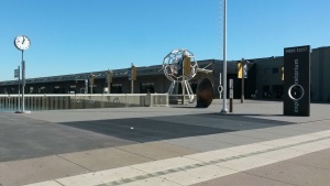
City: San Francisco
Directions
to and
from Exploratorium.
Historic streetcar
F-Market & Wharves line has stops along the Embarcadero at:
Embarcadero & Broadway Line - F-Market & Wharves, E EmbarcaderoEmbarcadero & Green Line - F-Market & Wharves, E EmbarcaderoEmbarcadero & Greenwich Line - F-Market & Wharves, E Embarcadero
The streetcar line continues south to the Ferry Building and downtown on Market Street. E-Embarcadero line provides special event service to Caltrain.
Ferries
The Ferry Building (with service to Oakland, Alameda, Larkspur, Vallejo) is less than 1/2 mile south of The Exploratorium.
BART, Muni Metro
The nearest stop for BART and Muni Metro is the Embarcadero Station, slightly more than 1/2 mile (9 blocks) south of the Exploratorium. F-Market & Wharves historic streetcar also provides connection between BART/Muni Metro and Exploratorium.
Bus
Bus stops are located within a few blocks from the museum:
Mill Valley (E Blithedale and Tower) - San Francisco
Sleepy Hollow/San Anselmo - San Francisco
East Petaluma - San Francisco
Santa Rosa - San Francisco via Rohnert Park and Cotati
All-nighter: San Francisco Zoo - Fisherman's Wharf
Folsom: Valencia & Caesar Chavez — Jackson Street & Van Ness
